Michigan Water Science Center
CURRENT CONDITIONS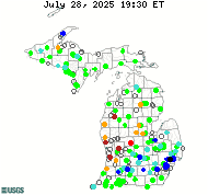
DATA CENTERReal-time data Historical data
ABOUT THE Michigan
|
NAWQA Projects
The National Water-Quality Assessment Program (NAWQA) provides an understanding of water-quality conditions; whether conditions are getting better or worse over time; and how natural features and human activities affect those conditions. Regional and national assessments are possible because of a consistent study design and uniform methods of data collection and analysis. Monitoring data are integrated with geographic information on hydrological characteristics, land use, and other landscape features in models to extend water-quality understanding to unmonitored areas. Local, State, Tribal, and national stakeholders use NAWQA information to design and implement strategies for managing, protecting, and monitoring water resources in Statewide different hydrologic and land-use settings across the Nation. The Michigan Water Science Center is analyzing groundwater for microbiological, major ions, pesticide, and trace metal constituents in the Lake Erie and Lake St. Clair study unit in southeast Michigan. The report can be accessed through Water Quality in the Lake Erie-Lake Saint Clair Drainages Michigan, Ohio, Indiana, New York, and Pennsylvania, 1996-98 USGS NAWQA Groundwater - Water-Quality Assessments of Principal Aquifers Chris Hoard, cjhoard@usgs.gov

The USGS implemented the National Water-Quality Assessment (NAWQA) Program in 1991 to develop long-term consistent and comparable information on streams, rivers, groundwater, and aquatic systems in support of national, regional, State, and local information needs and decisions related to water-quality management and policy. The NAWQA program is designed to address the following objectives and answer these questions:
1. What is the condition of our Nation's streams, rivers, and groundwater? USGS National Water-Quality Assessment Program

As part of the USGS National Water Quality Assessment (NAWQA) program the USGS MIWSC operates a stream gage and routinely collects water quality samples at the Clinton River at Sterling Heights, MI. station. Water is analyzed for sediment, nutrients, major ions, and a suite of 271 different pesticides. Information obtained from this site is compiled with information from other National Fixed Network Sites to understand water-quality conditions on a national scale. Current plans are to sample the Clinton River 24 times a year for chemistry, and twice a year for fish and biota from 2012 through 2022. Lori Fuller, lmfuller@usgs.gov
|
![]() U.S. Department of the Interior |
U.S. Geological Survey
U.S. Department of the Interior |
U.S. Geological Survey
URL: http://mi.water.usgs.gov/projects/NAWQAindex.html
Page Contact Information: gs-w-milns_webmaster@usgs.gov
Page Last Modified: Wednesday, 17-Jan-2018 12:59:07 EST

![[Map: There is a USGS Water Science Center office in each State.]](/_images/imagemaps/usmapsmall.gif)