Link to USGS home page.
*
Michigan Water Science Center
HOME | PROGRAMS AND PROJECTS | PUBLICATIONS | DATA ACCESS | PERSONNEL


Fluvial Geomorphology - Study of the Kalamazoo River

Objectives || Methods || Acknowledgements || Cooperators

Introduction

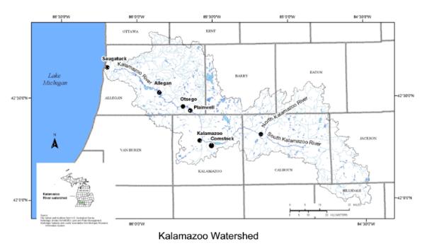
The Kalamazoo River has been designated as a Federal Superfund Site from the city of Kalamazoo to its mouth at Lake Michigan. Fluvial deposits from a variety of environments related to the Kalamazoo River contain elevated concentrations of polychlorinated biphenyls (PCBs) from paper-mill carbonless copy paper production (Blasland, Bouck, and Lee, 1994). There 
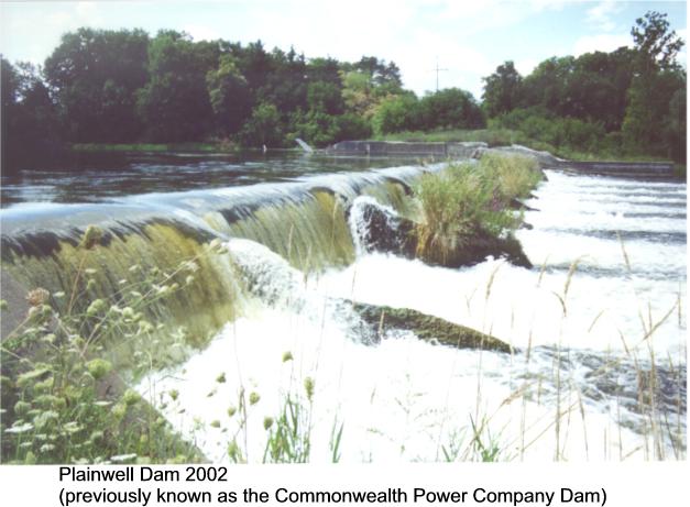
are four dams on the Kalamazoo River between Plainwell and Allegan. Pool levels behind the dams were lowered prior to state ownership in the late 1960s, exposing previously inundated sediment with elevated PCB concentrations. Dam superstructures were removed (leaving a sill) in 1987. PCB-laden sediment continued to be transported and deposited downstream of each dam as a new channel cut through the previously impounded reach.

The U.S. Environmental Protection Agency (USEPA) and Michigan Department of Environmental Quality (MDEQ) are interested in quantifying the current geomorphic condition of the river channel, its flood plain, wetlands, and previous depositional surfaces. They would like to identify areas with high bank erosion potential and reaches prone to channel avulsion.

The Michigan Department of Natural Resources (MDNR) is interested removing the dams and restoring the river channel to pre-dam conditions through this reach. Prior to removal, the MDNR and MDEQ would like to quantify the potential for PCB-laden sediment to become entrained and carried downstream after 
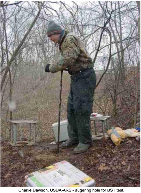
the dams are removed and channels are restored. The USGS is currently collecting suspended sediment, bedload sediment data, and channel cross section data that may be used in a transport model of sediment movement simulating the effects of removing the three dams. Preliminary observations indicate that the previously inundated surfaces fall into at least two elevation categories. One appears to currently be functioning as a flood plain and the other, somewhat lower surface, appears to be functioning as a wetland. This has caused some definitional complexity in the cleanup criteria applicable to the exposed sediment. The upland soil category doesn't seem to fit because both surfaces are frequently inundated, increasing the risk of exposure of high PCB concentrations for a variety of aquatic life.

Project objectives

* Qualitatively describe the regional hydrologic conditions of the Kalamazoo River compared to other large Great Lakes tributaries in Michigan.
* Construct the longitudinal profiles and gradients for the Kalamazoo River from its headwaters to the mouth for the following conditions: without dams, with dams in full operation, and with dam sills removed.
* Identify reaches of Kalamazoo River prone to avulsion based on historical records for 1827, 1938, 1960, and 2000 from Calhoun County line to Lake Michigan.
* Measure bank stability for reach from city of Plainwell to Otsego City dam. Estimate channel development and stability for current conditions. Determine pre-dam channel elevation and planform dimensions. Determine permanence of engineered banks under current conditions:

  • Tendency for river to cut around engineered portion
  • Bank erosion
  • Potential to meander
  • Frequency of inundation/impacts by extreme events

* Model bank and channel stability for the Plainwell to Otsego City Dam reach.

Methods

* Evaluate historical literature and aerial photography

* Use bank stability and sediment transport model

* Use channel evolution models (for long term changes and design)

Kalamazoo Watershed - Click image to go to larger photograph (50KB)
Commonwealth Power Company Dam, between Plainwell and Otsego, circa 1900- Click image to go to larger photograph (25KB)
Plainwell Dam 2002 (previously known as the Commonwealth Power Company Dam) - Click image to go to larger photograph (49KB)


Acknowledgements

  • Photo of Plainwell dam during early 1900s taken from History of Plainwell by Jean B. Whitney, 1978.
  • Logging photo taken from “A historical brief: Allegan Michigan 1938-1963”, James J. Green, 1963.
  • Photos depicting jet test and bore hole shear test set-up courtesy of Dave Fongers, MDEQ.
Cooperators:
USDA-ARS augering hole for BST test. - Click image to go to larger photograph (77KB)

Accessibility FOIA Privacy Policies and Notices

Take Pride in America logo USA.gov logo U.S. Department of the Interior | U.S. Geological Survey
URL:
Page Contact Information: Webmaster(gs-w-milns_webmaster@usgs.gov)
Page Last Modified: Last modified: June 23 2006 11:00:52.