 |
|
|
||||
| Michigan Water Science Center |
|
Project Chief Streamflow, physical properties, dissolved major and trace elements, solids,nutrient, and organic carbon. Station 04121640 - May 22, 2000 - Muskegon River near Big Rapids, Mich. (Upper) Station 04121650 - May 23, 2000 - Muskegon River at Big Rapids, Mich. (Lower) Suspended sediment and bedload data. Station 04121640 - Muskegon River near Big Rapids, Mich. (Upper) Station 04121650 - Muskegon River at Big Rapids, Mich. (Lower) Michigan Real-Time Water Quality Data Station 04121650 - Muskegon River at Big Rapids, Mich. (Lower) Reference Tables for Water Quality- Streamflow, physical properties, dissolved major and trace elements, solids, nutrient, and organic carbon. STATE/LOCAL COOPERATOR
Table of Contents |
PROPOSAL SUMMARY Effects of removal of a relic dam foundation on transport and fate of sediment, aquatic habitat, and water quality of the Muskegon River near Big Rapids, Michigan  The restoration of natural flow regimes to rivers has significant environmental and aesthetic benefits. In many cases, restoring a natural flow regime requires removing existing low-head dams. Such a dam exists on the Muskegon River at Big Rapids, Michigan. Removal of the dam would return the rapids to Big Rapids, increase recreational uses and safety of the river, and provide a more natural habitat. Removal of dams has attendant risks. In the Great Lakes watershed, where there are thousands of low-head dams, two of the most significant risks of dam removal are the movement of contaminated sediment downstream and the migration of invasive species from the Great Lakes upstream to headwater areas. Removal of the dam at Big Rapids does not have either of these risks and therefore would provide an ideal field-scale laboratory test for the effects of dam removal. The volume and grain-size distribution of sediments behind the dam at Big Rapids have been documented by the USGS (Westjohn, 1997); studies by the City of Big Rapids and Michigan DNR have documented that these sediments are contaminant-free (Sharon Hanshue, verbal commun. 1998). A study of dam removal at Big Rapids would provide valuable information for other dam removal projects in the Great Lakes watershed, including volume of material moving during and after dam removal compared to how much was projected to move, changes in channel morphology and geometry, changes in water quality parameters such as dissolved oxygen, and changes to riverine habitat. Additionally, models of sediment movement can be calibrated from monitoring data and be useful for modeling sediment movement on future dam removal projects. OBJECTIVEDocument the effects of dam removal on the river environment, including suspended and bed sediment load, flow, selected water quality parameters, and quality of aquatic habitat. Refine existing methods to predict these effects for application to other similar sites. 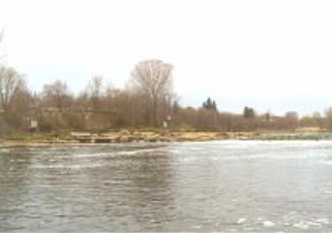 The current importance being placed on restoration makes it likely that removal of many dams and dam foundations in the upper Midwest will be considered in the future. Although many engineering studies address the environmental consequences of dam construction, the consequences of dam removal are typically unknown. The site provides an opportunity to monitor the actual mobilization, transport, and ultimate fate of sediment and has substantial potential to advance understanding these hydrologic processes and transfer knowledge to other sites. Refinement and improved accuracy of mathematical approaches to sediment transport and other impacts of small dam removal may mean that future studies to estimate impacts of dam removal may only require pre-removal "snapshots" of sediment availability and geomorphic assessments, rather than long-term monitoring, at substantial decrease in cost. Data from the proposed study will aid in making decisions regarding removal of similar structures more cost effective and scientifically based. The site is particularly instructive as a pilot for other dam removal in the Great Lakes region due to two factors mentioned in the problem statement: (1) the lack of contaminated sediments and (2) the presence of other dams downstream preventing invasion of exotic species.  1) Identify potential locations downstream that could be subject to deposition of sediment after dam removal. Conduct a geomorphic assessment to determine reach-to-reach differences along the stream channel. Qualitatively identify areas that are prone to sedimentation. The assessment will also identify potential effects on aquatic communities downstream. Only the physical effects of sediment will be addressed in this study because there is no evidence of sediment toxicity at this site. Effects on aquatic ecosystem could be inferred from predicted and measured sediment deposition, and are monitored directly in this study by habitat assessment using Great Lakes Environmental Assessment Strategy (GLEAS) procedure and USGS's National Water Quality Assessment transect procedure (modified). These habitat assessments integrate the effects since the last major hydrologic event, and are proposed during the low-flow period (summer months) once each before dam removal, during the year of dam removal, and during the following year. Assessments will occur at a minimum of 5 sites per trip: upstream of any dam effects, just above the dam, and at least 3 sites below the dam. 2) Estimate baseline sediment load before dam removal both upstream and below the dam. During and after removal, continue to monitor upstream (incoming) sediment load as well as load at and below the dam relic. Collect continuous and instantaneous discharge, and suspended sediment and bed material samples that represent various flow conditions, to identify current conditions. The gaging station will provide continuous daily discharge, which will be used to compute sediment transport load. 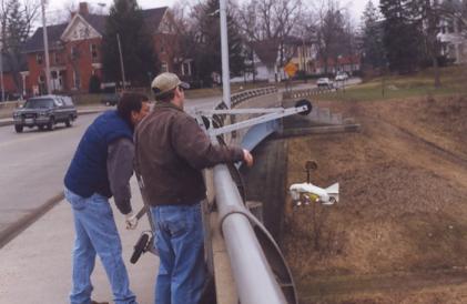
Sediment load generally varies both seasonally and with discharge. Suspended sediment samples will be collected using automatic samplers. Samples to be analyzed for sediment size distribution and concentration will be selected based on comparison with computed discharge, to assure that they represent a range of discharge conditions. Selection could represent rising and falling limb of a hydrograph during several storm events, spring runoff including ice dam/breakup, and/or seasonal composites. 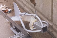
Depending on bed material size at the various sample sites, a combination of photographs, sand fraction using Helly-Smith samplers, Wolman pebble counts, and freeze cores will be used to quantify bedload. A limited number of samples will be collected upstream, to define natural sediment transport of the river. Temporary monitoring stations will be installed downstream from the foundation to periodically sample for sediment character and volume, during and after removal of the structure. Periodically conduct bottom sounding profiles and bed sediment distribution monitoring upstream and downstream of the structure, including some along the same transects where geophysical data and sediment-column cores were collected for determination of available sediment before dam removal. These data will allow determination of the changes in stream bed geometry, and provide data to determine sediment volume change as a function of time. Schedule needs to be flexible based on the results of early parts of this study, but conceptually: 1 day after each stage of dam removal, and 1 day prior to 2nd stage removal. Additional profiles 1 week, 1 month, and 2 months after removal complete. Location of sampling sites will also be flexible based on the results of early parts of the study, but could be located as far downstream as the upper portion of Roger's Lake. Discharge and selected suspended and bedload sediment data will continue to be collected through 2 spring runoff seasons after dam removal. 3) Establish a baseline for water quality by sampling for major constituents, nutrients, total organic carbon, pesticides, trace metals, turbidity and suspended solids during low flow and high flow, above and below the dam. Repeat the sampling after dam removal to identify possible changes. Monitor temperature, dissolved oxygen, conductivity at gaging station and above the dam before, during, and after removal to document changes, such as anaerobic conditions, that may result from suspended sediment. 4) Predict sediment transport and fate using existing equations/models; compare observed results with predicted to improve ability to predict effects of dam removal at other similar sites without need for extensive monitoring. Empirical formulas and numerical models exist to help estimate how far the various sizes of sediments will travel before settling out. These models will be applied initially and refined as data become available after dam removal. Technical results of the project will be published in a USGS Water Resources Investigation report or journal article(s) and presented at appropriate technical conference(s). A 4-6 page fact sheet targeted at a nontechnical audience will also be produced and made available both in paper format and on the Internet. |

![]() U.S. Department of the Interior |
U.S. Geological Survey
U.S. Department of the Interior |
U.S. Geological Survey
URL:
Page Contact Information: Webmaster(gs-w-milns_webmaster@usgs.gov)
Page Last Modified: Last modified: June 23 2006 11:00:51.