Michigan Water Science Center
CURRENT CONDITIONS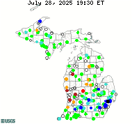
DATA CENTERReal-time data Historical data
ABOUT THE Michigan
|
Surface Water Projects")
AFINCH (Analysis of Flows in Networks of CHannels) is a computer application designed to generate time series of monthly flows at stream segments and corresponding water yields at catchments defined in the National Hydrography Dataset (NHDPlus, v. 2). AFINCH provides a basis for integrating monthly flow data from streamgages, water-use data, monthly climatic data, land-cover and catchment attributes described in user-defined shapefiles to estimate natural monthly water yields from catchments. AFINCH provides an interactive process for the user to develop sets of multiple-regression equations for estimating monthly water yields. Images of monthly water yields for active streamgages are generated in AFINCH and provide a basis for detecting anomalies in water yields, which may be associated with undocumented flow diversions or augmentations. Water yields are multiplied by the drainage areas of the corresponding catchments to estimate monthly flows. Flows from catchments are accumulated downstream through the streamflow network described by the stream segments. For stream segments where streamgages are active, computed flows are constrained to match measured flows. Flow is conserved through the NHDPlus network. Generated time series of monthly flows can be tested for trends and used to develop monthly flow duration curves. For more information, see the report. Dave Holtschlag, dholtschlag@usgs.gov 
Low-Flow Streamgage Network in Michigan
Data on low-flow characteristics are used by water-resources managers for a variety of purposes, including water-supply planning, making decisions about wastewater-discharge and water withdrawal permits, and evaluating in-stream flow requirements. The Michigan low-flow network currently consists of seven sites where streamflow is typically measured only during low-flow periods. In addition to these dedicated low-flow sites, low-flows are also targeted for measurement at the remainder of the streamgaging throughout the state, as needed. Tom Weaver, tlweaver@usgs.gov

The USGS in Michigan-in cooperation with local, State, Tribal, and Federal partners-operates 155 streamgages recording stage and streamflow, and 13 lake-level gages. There are about 7,400 streamgages nationwide; many of these gages provide real-time data in 15-minute increments, which typically are transmitted to the World Wide Web every 1 to 2 hours using satellite, telephone, or cellular phone technologies. These streamgages provide streamflow information for a wide variety of uses including flood prediction, water management and allocation, engineering design, research, and recreational safety and enjoyment. In addition to these data, field measurement data, streamflow statistics, and annual peak streamflows from each station are available on the Web through the National Water Information System (NWIS) Tom Weaver, tlweaver@usgs.gov

Crest-Stage Streamgage Network in Michigan
Historically, small streams with drainage areas less than 100 square miles have not been adequately represented in regional peak- (high) flow analysis. In Michigan, USGS operates 24 traditional crest-stage gages, where stage and streamflow is only measured during high flows, and 6 continuous-record crest-stage gages, where cooperators can continually monitor stage and USGS maintains a high-flow stage discharge rating. In addition to providing peak stage and streamflow information for cooperators, information from the 30 sites is available for hydrologists and others to use in regional and statewide flood-frequency analyses. Tom Weaver, tlweaver@usgs.gov

Response to an oilspill on the Kalamazoo River
Enbridge Energy Partners LLP (Enbridge) reported a 30-inch pipeline ruptured on Monday, July 26, 2010, near Marshall, Michigan. The release, estimated at 819,000 gallons, entered Talmadge Creek and flowed into the Kalamazoo River, a Lake Michigan tributary. Heavy rains caused the river to overtop existing dams and carried oil 30 miles downstream on the Kalamazoo River. As the federal agency in charge of the response to the spill, EPA assumed a leadership role in the Unified Command and mobilized an Incident Management Team made up of federal, state and local agencies. USGS provided technical assistance throughout the recovery effort, specifically for aspects of hydrodynamic modeling, geomorphology, and field data collection. The report can be accessed through Chris Hoard, cjhoard@usgs.gov

Connecting Channels
In response to decreasing water levels in the Great Lakes, especially Lake Michigan and Lake Huron, the International Upper Great Lakes Study (IUGLS) asked USGS to continuously measure flows in the connecting channels of St. Marys, St. Clair, and Detroit Rivers, and Water Survey Canada (WSC) to measure flows of Niagara River. To accommodate the effects of variable backwater and the unsteadiness of flows in the upper channels, the USGS deployed fixed-location acoustic Doppler velocity meters (ADVM) to continuously monitor water velocities at a point along each of these channels, along with water levels. Velocity and water-level data were initially related to channel flows through a series of acoustic Doppler current profiler (ADCP) flow measurements beginning in 2008. Continuous flow information based on these data became available for St. Clair and Detroit Rivers in 2009, and for the St. Marys River in 2010. These velocity-stage-flow relations are continually monitored and refined as additional data become available. The International Joint Commission currently provides funding needed to support data collection and analysis at these streamgages. Classification of these streamgages as International Gaging Stations would help secure long-term funding and operation. Tom Weaver, tlweaver@usgs.gov

Acoustics
Michigan Water Science Center used acoustic meters for about 90 percent of the streamflow measurements made in Fiscal Year 2012. Wading measurements are done using a modified top setting wading rod equipped with an acoustic Doppler velocimeter (ADV). Acoustic Doppler current profilers (ADCP) are used when measurement depths are too deep to wade. ADCP measurements can either be made with a tether or cableway or deployed on a manned boat. Streamflow in nine locations where backwater or other conditions preclude the use of a conventional stage-discharge rating are measured using fixed acoustic Doppler velocity meters (ADVM) mounted both horizontal and vertical to the principal flow direction. Acoustic instrumentation has also been used to map cross-sectional and longitudinal areas for studies of critical Asian carp habitat in the St. Joseph, Maumee, and Sandusky Rivers and in conjunction with research following the oil spill in 2011 on the Kalamazoo River. Don James, dajames@usgs.gov
|
![]() U.S. Department of the Interior |
U.S. Geological Survey
U.S. Department of the Interior |
U.S. Geological Survey
URL: http://mi.water.usgs.gov/projects/SWindex.html
Page Contact Information: gs-w-milns_webmaster@usgs.gov
Page Last Modified: Tuesday, 03-Jan-2017 11:07:35 EST

![[Map: There is a USGS Water Science Center office in each State.]](/_images/imagemaps/usmapsmall.gif)