Great Lakes Basin Pilot
Surface-Water Flows and Storage
The major tasks include:
Status
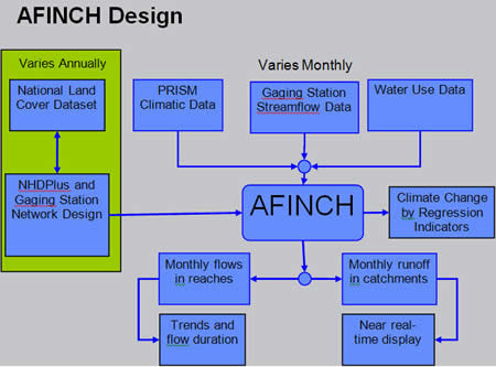
A prototype model, aFINCH (analysis of Flows in Networks of Channels), has been developed and applied to a hydrologic subregion within the U.S. Great Lakes Basin (0405).
The model provides an estimator of flows in reaches and runoff from catchments in the NHDPlus network. Features of the estimator include:
- Consistent with monthly flows measured at USGS streamflow gaging stations;
- Account for water withdrawals, diversions, and augmentations;
- Robust estimates of flows and runoff at ungaged sites that are consistent with environmental factors affecting measured natural flows, which are gaged flows adjusted for water use;
- Conserve mass through the network;
- Support near real-time estimation;
- Provide extensive graphical support for input and output;
- Nonproprietary, open-source code that can be made portable across the USGS network.
 |
A schematic of the design of aFINCH and example results from the application of this model for October, 2003. |
 |
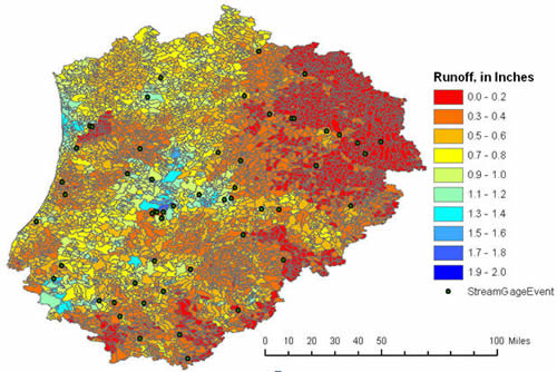
Constrained run-off for October, 2003 from aFINCH analysis for hydrologic subregion 0405. |
 |
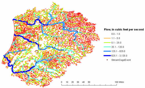
Accumulated flow in NHDplus stream network for hydrologic subregion 0405 for October, 2003 estimated using aFINCH constrained regression. |
|