Water Resources of Michigan
Contents of Michigan's Source-Water Assessment Program – Surface-Water Assessments Leading To Protection Initiatives
US Geological Survey RTS# MI-0121
Lansing, Michigan 2002
By: M. J. Sweat, B. B. Brogren, R. S. Jodoin, T. A. Rossi, and M. W. Loerop
U.S. DEPARTMENT OF THE INTERIOR
GALE NORTON, Secretary
U.S. GEOLOGICAL SURVEY
Charles G. Groat, Director |
Prepared in cooperation with the MDEQ
- Drinking Water and Radiological Protection Division |
| Any use of trade, product, or firm names in this publication
is for descriptive purposes only and does not imply endorsement by the U.S.
Government. |
Accessible Web version is available in Web (HTML) format at:
http://mi.water.usgs.gov/pubs/MISC/RTSMI-0121/RTSMI-0121LW.php
 Portable Document format (pdf) at:
Print-Optimized PDF file (1.7MB)
http://mi.water.usgs.gov/pubs/MISC/RTSMI-0121/pdf/WTO222b.pdf
If you do not have Adobe Acrobat Reader, then you can download it for free at:
http://www.adobe.com/products/acrobat/readstep2.html
Use of this software product does not imply endorsement by U.S. Government.
Contents
FIGURES
Maps showing:
-
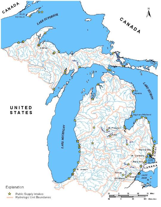
Location of Water Supplies in Michigan using Surface Water as their Source.
-
Source-water for the Adrian, Alpena, and Detroit - Belle Isle, Michigan, Water Supply Intakes.
-
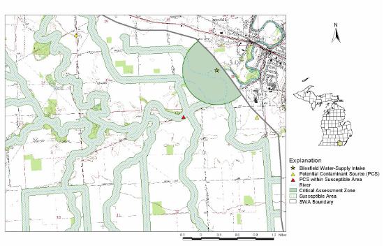
Critical assessment zone (CAZ) and susceptible area for the Blissfield, Michigan, water-supply on the River Raisin
-
Critical assessment zone (CAZ) determination (modified from Brogren, 1999)
-
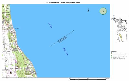
Critical assessment zone (CAZ) for the Detroit Water and Sewerage Department Lake Huron intake in Lake Huron
-
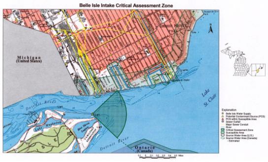
Critical assessment zone (CAZ) and susceptible area for the Detroit Water and Sewerage Department Belle Isle intake in the Detroit River
-
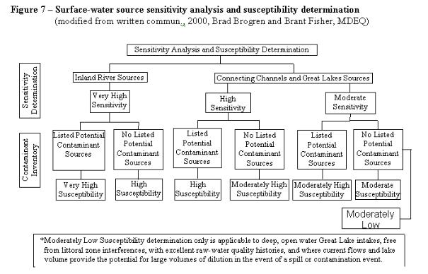
Surface-water source sensitivity analysis and susceptibility determination (modified from written commun., 2000, Brad Brogren and Brant Fisher, MDEQ)
-
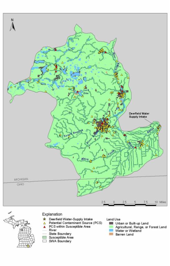
Contaminant source inventory map for the Deerfield water supply
Tables
- Water
supplies in Michigan using surface-water as their source, by supply type
- Water
supplies participating in pilot assessments
- Types
of potential contaminant sources in the SWA for the Alpena WTP
- Factors
considered in determining susceptible areas
For additional information
write to:
District Chief
U.S. Geological Survey, WRD
6520 Mercantile Way, Suite 5
Lansing, MI 48911-5991
|
Ordering information:
Phone: 800-666-0206 or 703-684-2452
Email: [email protected]
Online: www.wef.org/applications/periodicals
The Online Library enables you to download individual articles and papers.
|
Citation:
Sweat, M.J.1, Brogren, B.B.2, Jodoin, R.S.1, Rossi, T.A.1, and Loerop, M.W.1, 2002, Michigan�s Source-Water Assessment Program � Surface-Water Assessments Leading To Protection Initiatives, RTS# MI-0121
1 U.S. Geological Survey, 6520 Mercantile Way, Suite 5, Lansing, MI 48911
2 MDEQ—Drinking Water and Radiological Protection Division, Lansing, MI 48909
Back to USGS, WRD Michigan Home Page
