
Water Resources of Michigan
Contents of An Annotated Bibliography of Selected References on the Estimated Rates of Direct Ground-Water Discharge to the Great Lakes
US Geological Survey Water-Resources Investigations Report 98-4039
Lansing, Michigan 1998
By: Norman G. Grannemann and Thomas L. Weaver
Accessible Web version is available in Web (HTML) format at:
http://mi.water.usgs.gov/pubs/WRIR/WRIR98-4039/WRIR98-4039LW.php
| U.S. DEPARTMENT OF THE INTERIOR BRUCE BABBITT, Secretary U.S. GEOLOGICAL SURVEY Charles G. Groat, Director |
Prepared in cooperation with the U.S. Army Corps of Engineers Detroit District |
Pathways for Ground-Water Movement to the Great Lakes
Discharge from Near-Shore Sources
Lake Superior and St. Marys River
Maps showing:
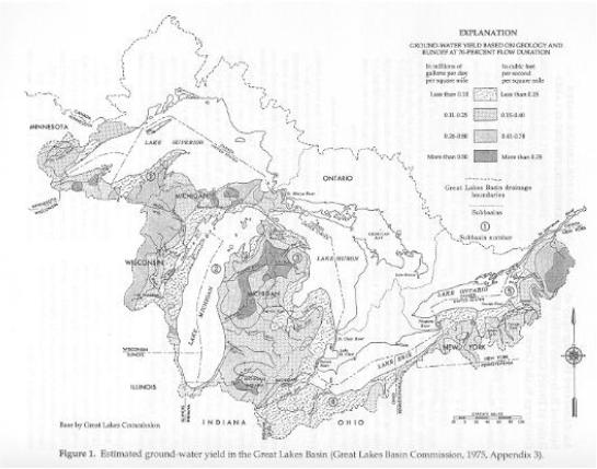
1. Estimated ground-water yield in the Great Lakes
Basin (Great Lakes Basin Commission,
1975, Appendix 3)
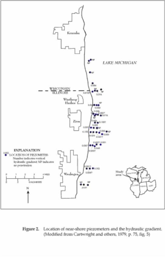
2. Location of near-shore piezometers and the
hydraulic gradient (Modified from
Cartwright and others, 1979)
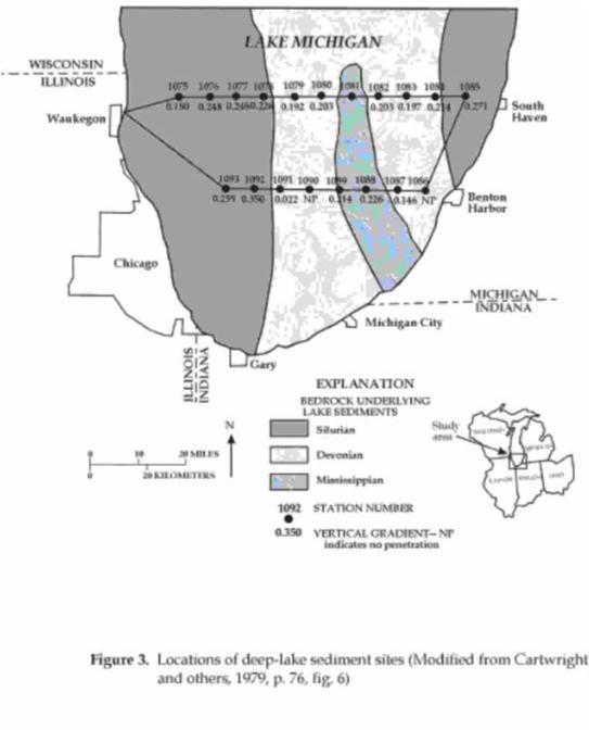
3. Locations of deep-lake sediment sites (Modified
from Cartwright and others, 1979)
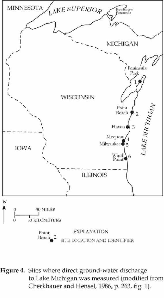
4. Six sites where direct ground-water discharge
to Lake Michigan was measured
(Modified from Cherkhauer and Hensel, 1986)
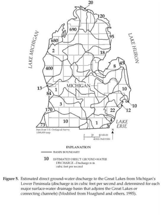
5. Estimated direct ground-water discharge to
Great Lakes from Michigan's Lower
Peninsula (Modified from Hoaglund and others, 1995)
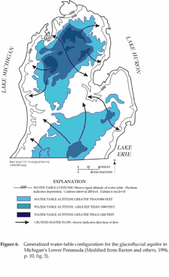
6. Generalized water-table configuration for the
glaciofluvial aquifer in Michigan's
Lower Peninsula (Modified from Barton and others, 1996)
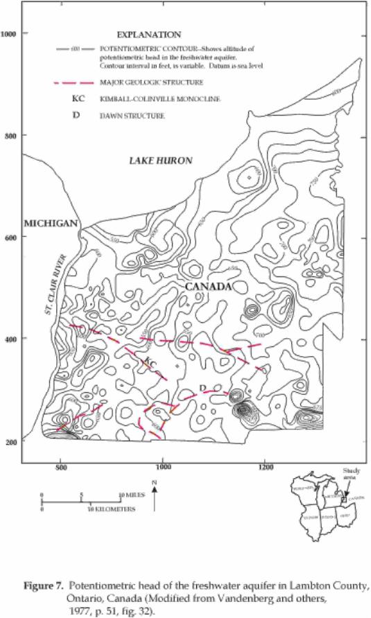
7. Potentiometric head of the freshwater aquifer
in Lambton County, Ontario, Canada
(Modified from Vandenberg and others, 1977)
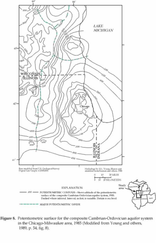
8. Potentiometric surface for the composite Cambrian-Ordovician
aquifer system in the
Chicago-Milwaukee area, 1985 (Modified from Young and others, 1989)
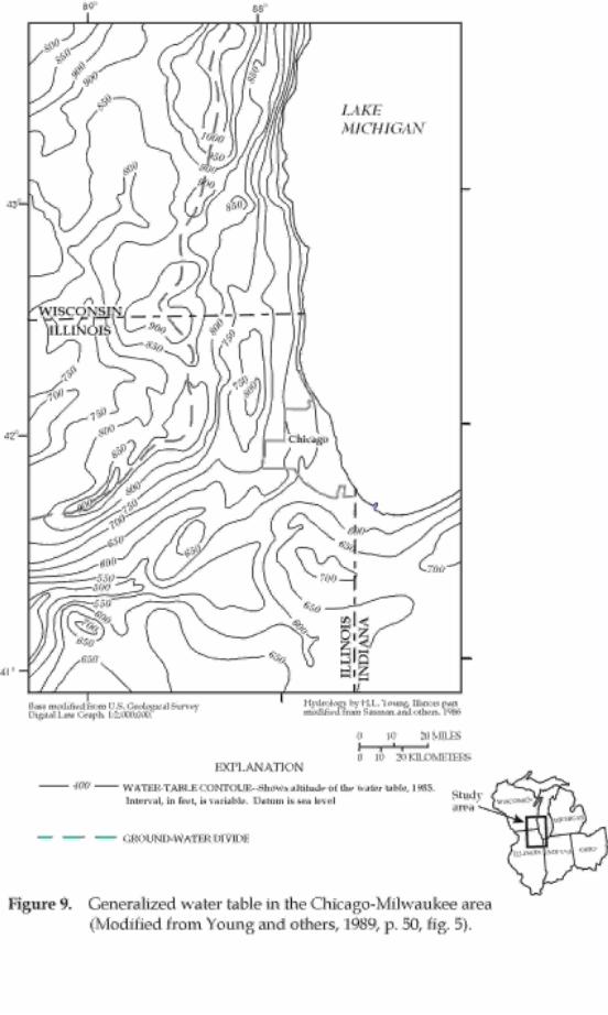
9. Generalized water table in the Chicago-Milwaukee
area (Modified from Young and others, 1989)
1. Ground-water discharges to the connecting
channels in the upper Great Lakes
(Taylor and Cherkauer, 1987)
2. Comparison of total direct ground-water
discharge to Lake Ontario from the
Canadian side computed using four methods (Haefeli, C.J., 1972)
3. Summary of estimated rates of direct
ground-water discharge to the Great Lakes
from published values
| CONVERSION FACTORS AND VERTICAL DATUM | |||
|---|---|---|---|
| CONVERSION FACTORS | |||
| Multiply | By | To obtain | |
| cubic foot (ft3) | 0.02832 | cubic meter | |
| foot (ft) | 0.3048 | meter | |
| foot per second (ft/s) | 30.48 | centimeter per second | |
| million gallons per day (Mgal/d) | 0.003785 | cubic meters per day | |
| square foot (ft2) | 0.0929 | square meter | |
| square mile (mi2) | 2.59 | square kilometer | |
| VERTICAL DATUM: In this report, "sea level" refers to the National Geodetic Vertical Datum of 1929—a geodetic datum derived from a general adjustment of the first-order level nets of both the United States and Canada, formerly called Sea Level Datum of 1929. | |||
| For additional information write to:
|
Copies of this report can be purchased from:
|
Citation: