
Water Resources of Michigan
Contents of Ground-Water Flow and Contributing Areas to Public -Supply Wells in Kingsford and Iron Mountain, Michigan
US Geological Survey Water-Resources Investigation 00-4226
Lansing, Michigan 2001
By: Carol L. Luukkonen and D. B. Westjohn
| U.S. DEPARTMENT OF THE INTERIOR BRUCE BABBITT, Secretary U.S. GEOLOGICAL SURVEY Charles G. Groat, Director |
Prepared in cooperation with the cities of Kingsford and Iron Mountain, Michigan |
| Any use of trade, product, or firm names in this publication is for descriptive purposes only and does not imply endorsement by the U.S. Government. | |
Long Version available in Web (HTML) format at:
http://mi.water.usgs.gov/pubs/WRIR/WRIR00-4226/WRIR00-4226LW.php
Contents
FIGURES
Maps showing:
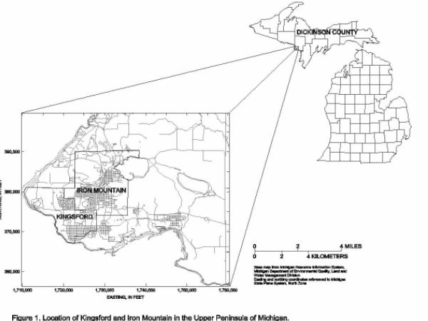
1. Location of Kingsford and Iron Mountain
in the Upper Peninsula of Michigan
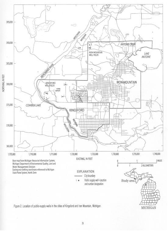
2. Location of public-supply wells in
the cities of Kingsford and Iron Mountain, Michigan
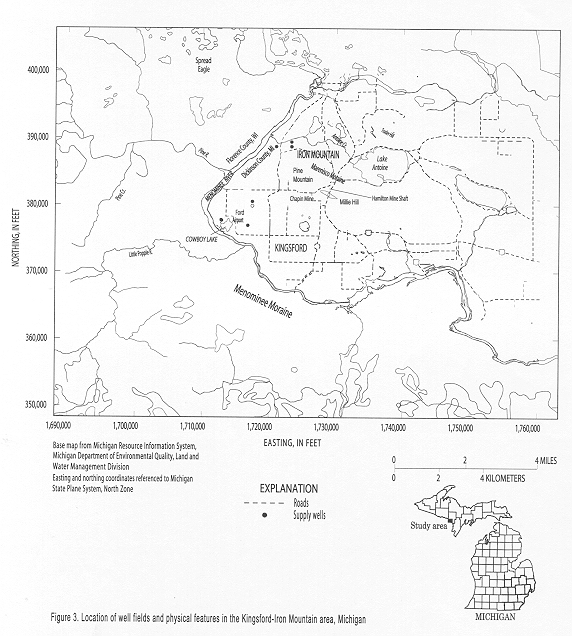
3. Location of well fields and physical
features in the Kingsford-Iron Mountain area, Michigan
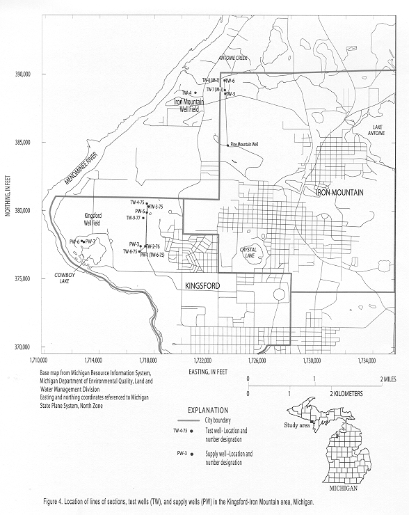
4. Location of lines of sections and test
and supply wells, in the Kingsford-Iron Mountain area, Michigan
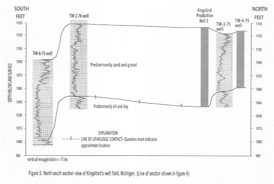
5. North-south section view of Kingsford's
well field, Michigan
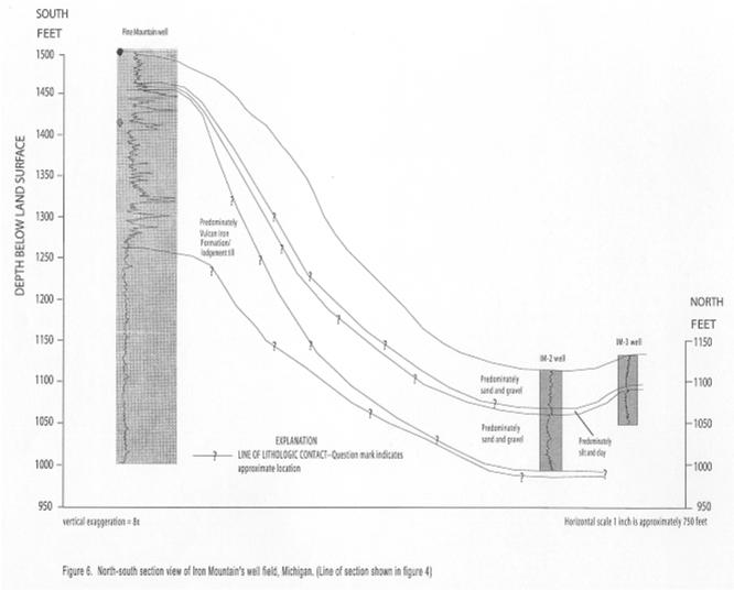
6. North-south section view of Iron Mountain's
well field, Michigan
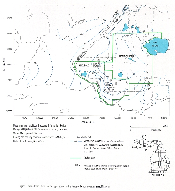
7. Ground water levels in the upper aquifer
in the Kingsford-Iron Mountain area, Michigan
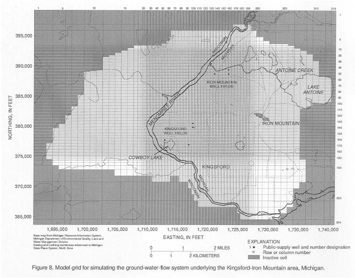
8. Model grid for simulating the ground-water-flow
system underlying the Kingsford-Iron Mountain area, Michigan
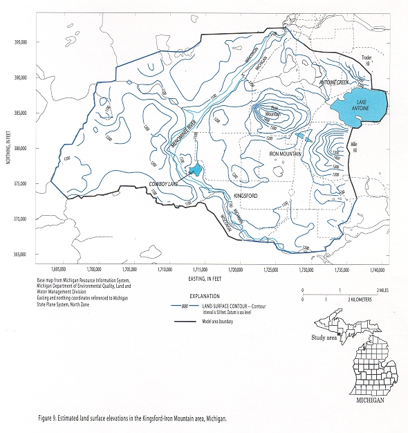
9. Estimated land surface elevations,
Kingsford-Iron Mountain area, Michigan
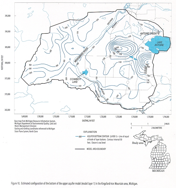
10. Estimated configuration of the bottom
of the upper aquifer (model layer 1), in the Kingsford-Iron Mountain area, Michigan
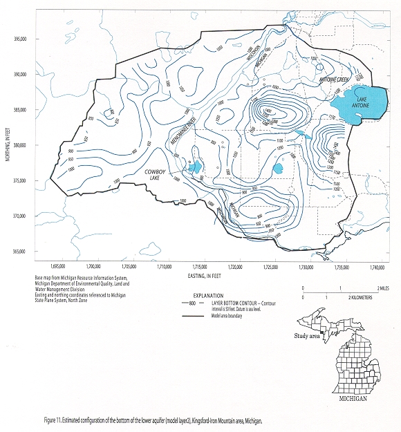
11. Estimated configuration of the bottom
of the lower aquifer (model layer 2), Kingsford-Iron Mountain area, Michigan
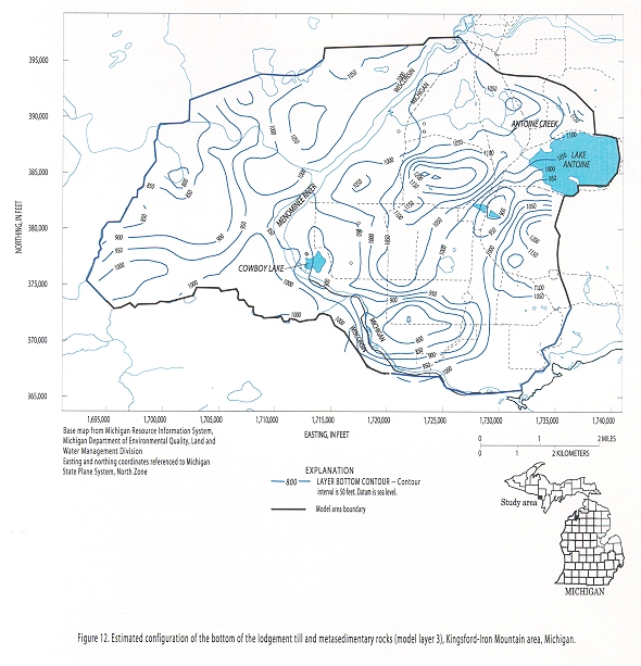
12. Estimated configuration of the bottom
of the lodgement till and metasedimentary rocks (model layer 3), Kingsford-Iron
Mountain area, Michigan
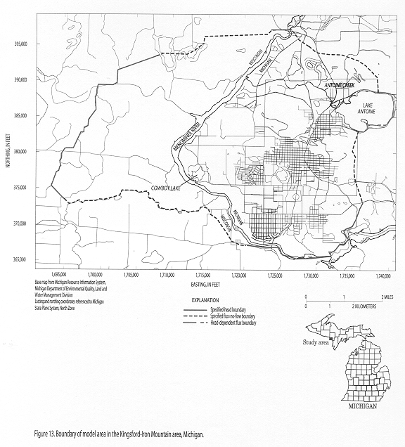
13. Boundary of model area, in the Kingsford-Iron
Mountain area, Michigan
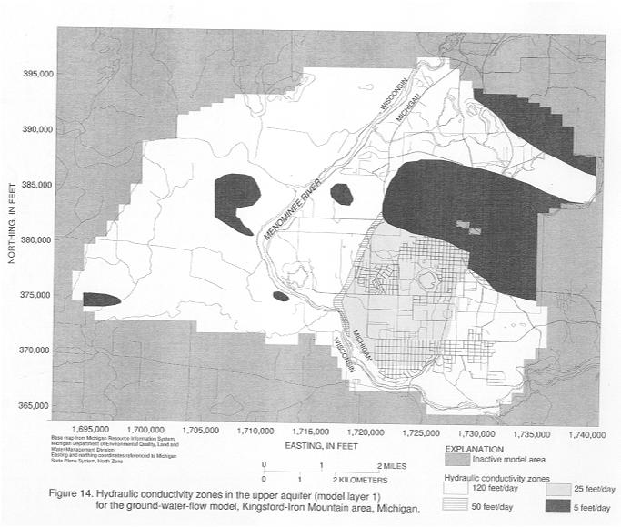
14. Hydraulic conductivity zones in the
upper aquifer (model layer 1) for the ground-water-flow model, Kingsford-Iron
Mountain area, Michigan
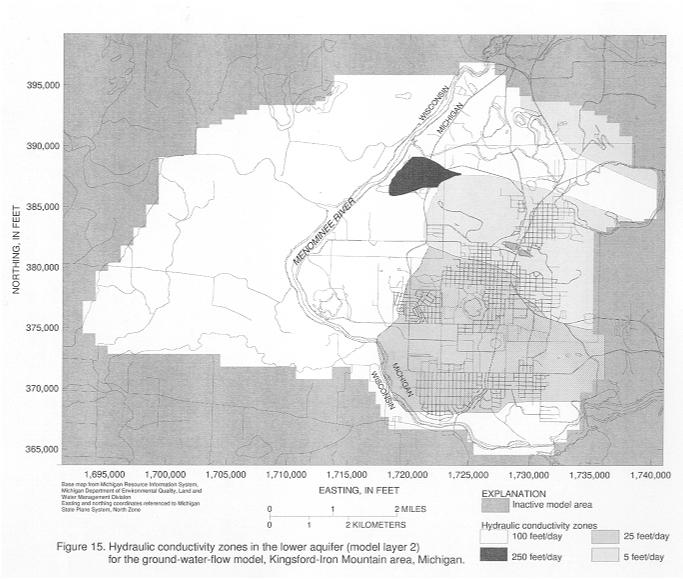
15. Hydraulic conductivity zones in the
lower aquifer (model layer 2) for the ground-water-flow model, Kingsford-Iron
Mountain area, Michigan
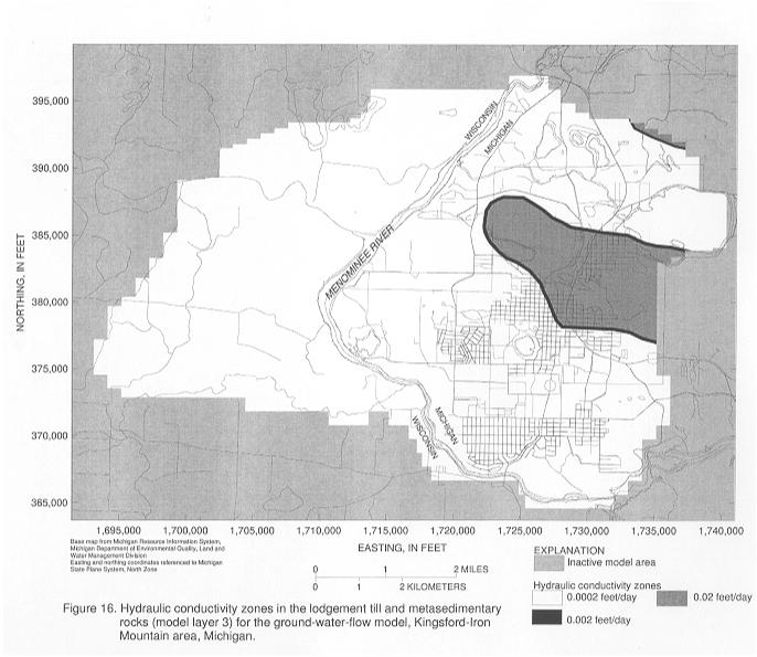
16. Hydraulic conductivity zones in the
lodgement till and metasedimentary rocks (model layer 3) for the ground-water-flow
model, Kingsford-Iron Mountain area, Michigan
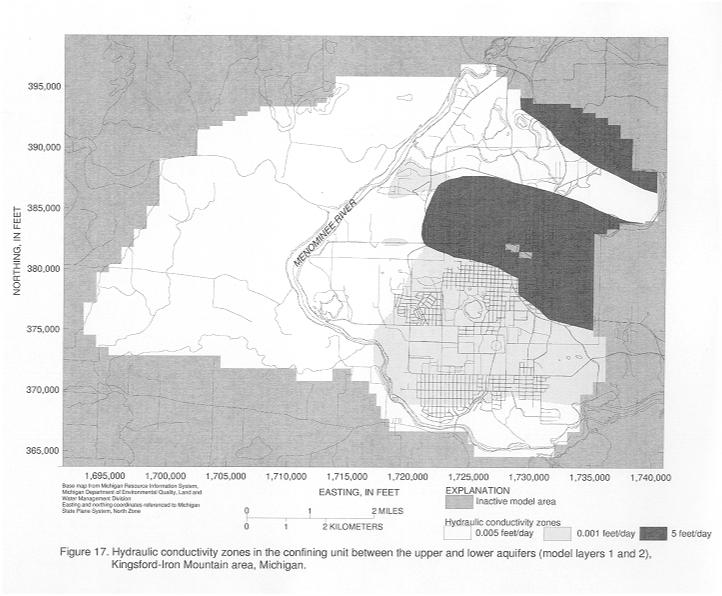
17. Hydraulic conductivity zones in confining
unit between the upper and lower aquifers (model layers 1 and 2), Kingsford-Iron
Mountain area, Michigan
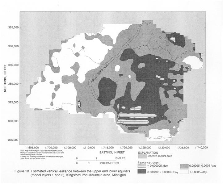
18. Estimated vertical leakance between
the upper and lower aquifers (model layers 1 and 2), Kingsford-Iron Mountain
area, Michigan
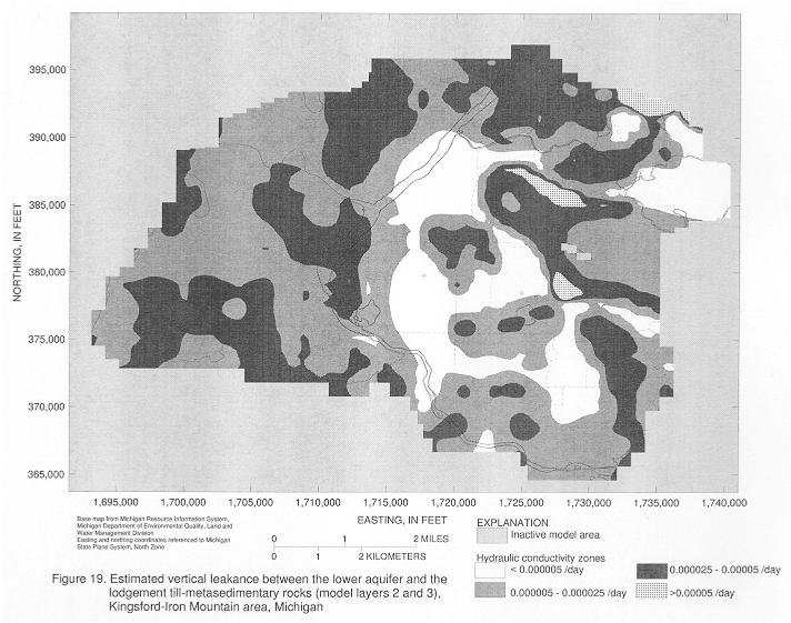
19. Estimated vertical leakance between
the lower aquifer and the lodgement till-metasedimentary rocks (model layers
2 and 3), Kingsford-Iron Mountain area, Michigan
Graphs showing:
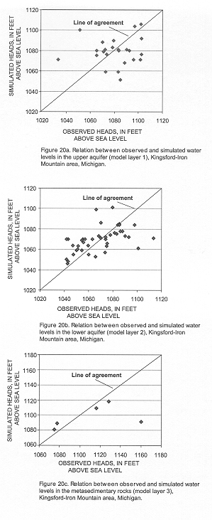
20a. Relation between observed and simulated
water levels in the upper aquifer (model layer 1), Kingsford-Iron Mountain area,
Michigan
20b. Relation between observed and simulated
water levels in the lower aquifer (model layer 2), Kingsford-Iron Mountain area,
Michigan
20c. Relation between observed and simulated
water levels in the metasedimentary rocks (model layer 3), Kingsford-Iron Mountain
area, Michigan
Maps showing:
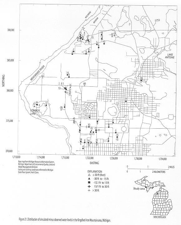
21. Distribution of simulated minus observed
water levels in the Kingsford-Iron Mountain area, Michigan
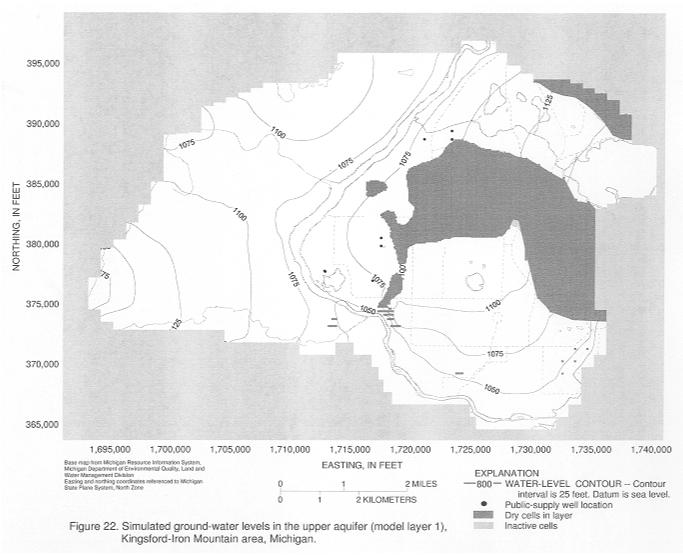
22. Simulated ground-water levels in
the upper aquifer (model layer 1), Kingsford-Iron Mountain area, Michigan
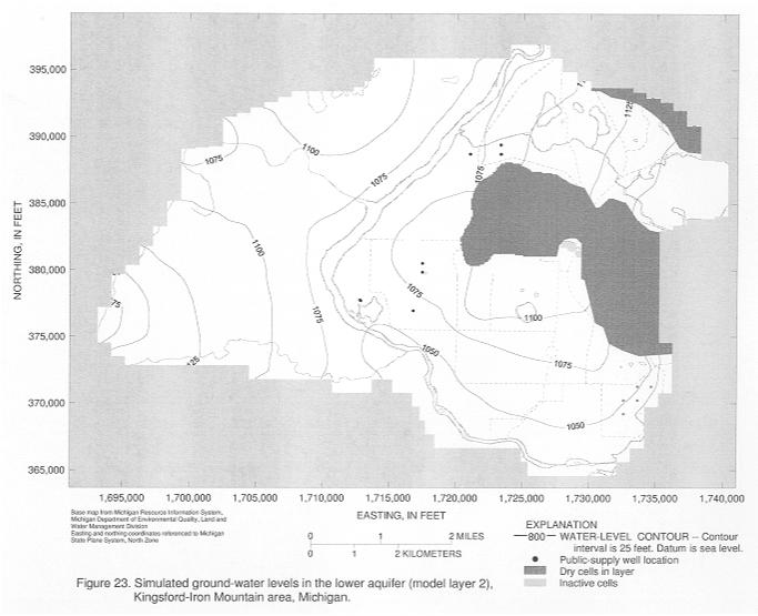
23. Simulated ground-water levels in
the lower aquifer (model layer 2), Kingsford-Iron Mountain area, Michigan
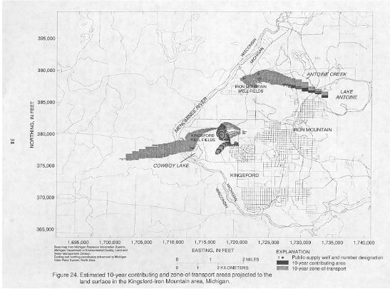
24. Estimated 10-year contributing and
zone of transport areas projected to land surface in the Kingsford-Iron Mountain
area, Michigan
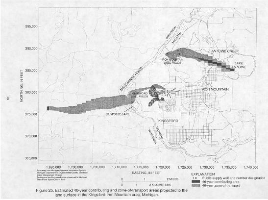
25. Estimated 40-year contributing and
zone of transport areas projected to land surface in the Kingsford-Iron Mountain
area, Michigan
Tables
1. Estimated transmissivities for the
glacial aquifers underlying Kingsford and Iron Mountain well fields, Michigan
2. Initial horizontal and vertical hydraulic
conductivity estimates for layer zones in the Kingsford-Iron Mountain ground-water-flow
model, Michigan
3. Final hydraulic conductivity estimates
for layer zones in the Kingsford-Iron Mountain ground-water-flow model, Michigan
4. Ground-water-flow model budget, Kingsford-Iron
Mountain, Michigan
Tables-Appendix
1a. Root mean square error values for
selected scenarios
| For additional information write to:
|
Copies of this report can be purchased from:
|